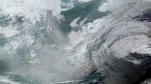
A June 2023 image from National Oceanic and Atmospheric Administration’s GOES-16 satellite shows smoke from wildfires in Canada over the midwest and northeastern regions of the U.S. GOES-16 was the first of four geostationary weather satellites in the GOES-R series. (Image via NOAA)
Interior and the Forest Service will work with NOAA to use data from a fleet of weather satellites to improve the speed and accuracy of wildfire tracking.
A new report highlights how automation and process mining tools give agencies, including USDA, IRS and the U.S. Navy, new abilities to modernize operations.