Simultaneous drones, better data: NOAA hurricane tech hits milestones
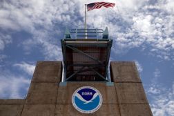
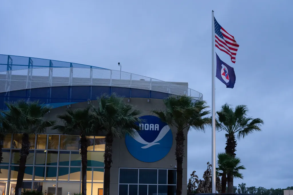
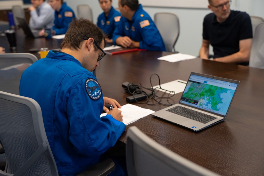
LAKELAND, Fla. — Gusts of wind pulled flags taut outside a conference room window in NOAA’s central Florida-based Aircraft Operations Center as crewmembers went over the flight plan for an emerging hurricane tech-testing day.
It was early April, statistically one of the state’s driest months; nevertheless, the skies were overcast and light rain sprinkled throughout the morning.
But rather than throwing a damper on the plans, the weather was a source of excitement for those gathered around the long conference table. For the first time, there was an opportunity to evaluate budding technologies — including plane-deployed drones — in precipitation ahead of the hurricane season.
“For today, one thing we really want to test is: does rain affect the quality of the data, too?” Josh Wadler, a meteorologist and assistant professor at Embry-Riddle Aeronautical University, told FedScoop after the meeting.
Although NOAA’s Hurricane Hunters fly through massive amounts of precipitation during actual storms, a rainy day hadn’t yet presented itself in the team’s roughly five years of spring testing for its budding tools. Such controlled evaluations outside of hurricanes help build confidence in the technology.
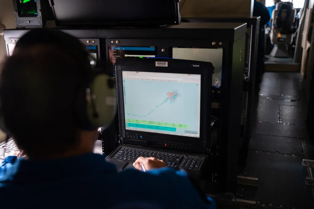
When NOAA transmits data from its newer tools, questions about accuracy and how much that information can be trusted come back, Wadler explained while walking down the winding hallways of the operations center. “These are the types of experiments that help us answer those questions,” he said.
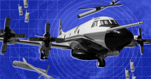
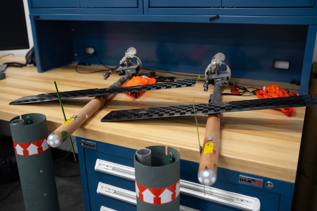
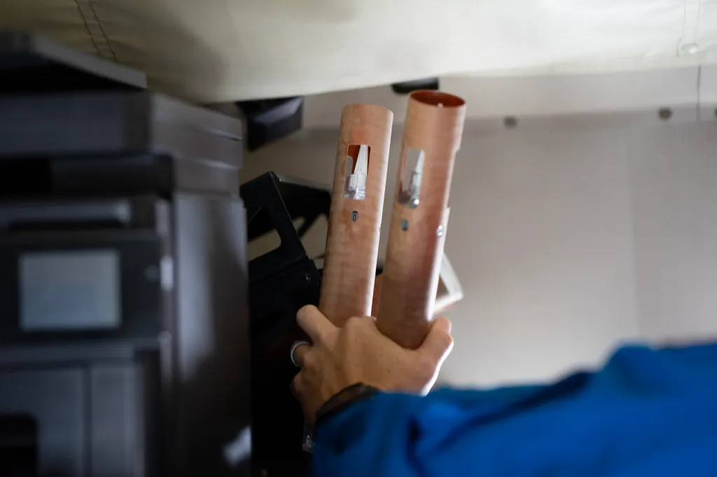
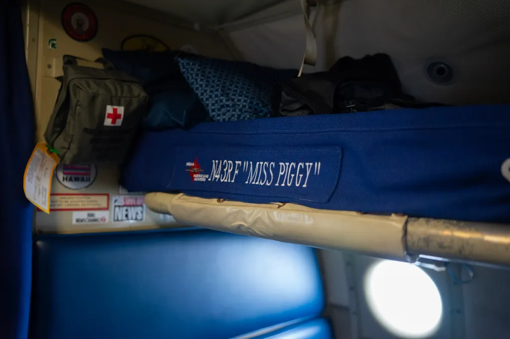
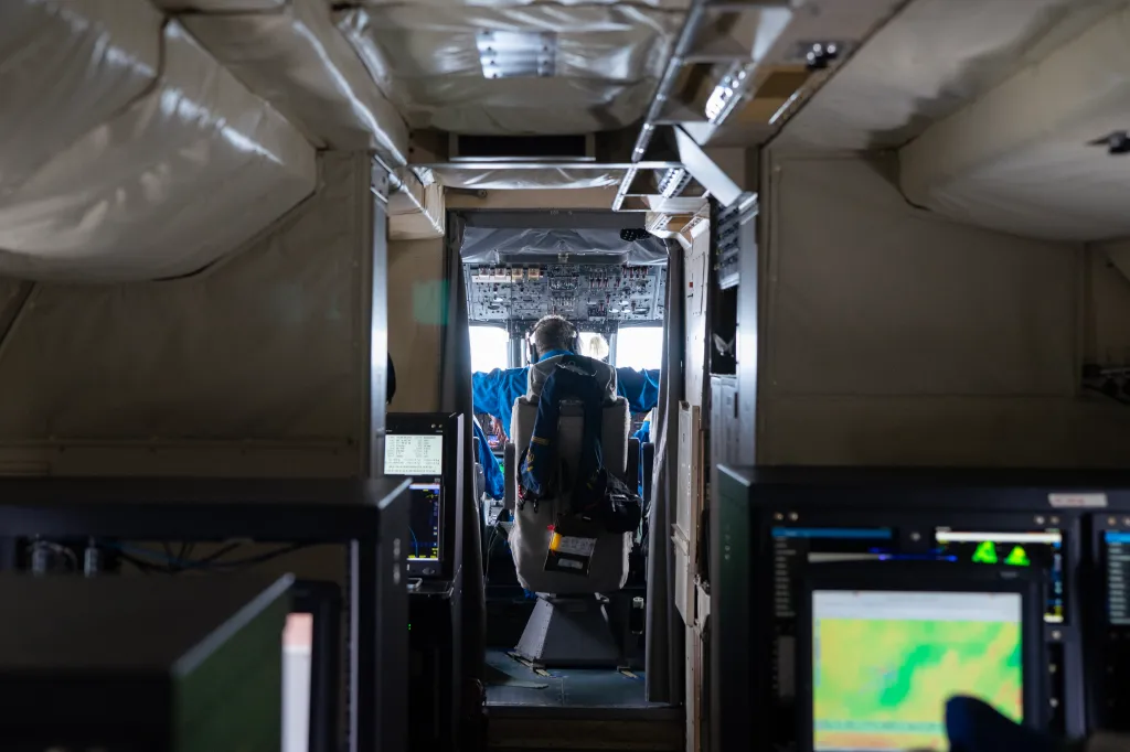
On April 7, FedScoop embedded with NOAA’s Hurricane Hunters and emerging technology researchers to see the progression of the fledgling tools up close. During a roughly five-hour flight in a plane known as “Miss Piggy” — one of the agency’s two Lockheed WP-3D Orion aircraft — researchers deployed two Black Swift SØ drones and several small devices that collect data on their descents.
Similar to an actual hurricane flight, those tools were systematically deployed by hand through chutes in the bottom of the aircraft at various points and altitudes. Among the functions being evaluated: the performance of newer and less expensive tools and flying two unmanned aircraft systems (UAS) at once.
But perhaps most notably, the test day came at something of an inflection point for the agency’s UAS technology. The data from the SØ drones (spoken as “S zero”) will be used in NOAA’s hurricane models for the first time this storm season — a milestone for the agency’s efforts to improve forecasts with cutting-edge tools.
NOAA recently announced that a preliminary study found inputting UAS data into its Hurricane Analysis and Forecast System improved the accuracy of the intensity forecast by 10%. As the hurricane season that began June 1 takes shape, better data could translate into information that saves lives.
The achievement is the exact thing that the emerging technologies team set out to accomplish when it began exploring the use of drones in hurricanes over a decade ago.
“This is the first year where it was really smooth, and that’s not a coincidence,” said Joseph Cione, lead meteorologist for emerging technologies with the Hurricane Research Division at NOAA’s Atlantic Oceanographic and Meteorological Lab. “I think it’s from everything we learned before, and the Black Swift is just ready to go.”
The toolbox onboard
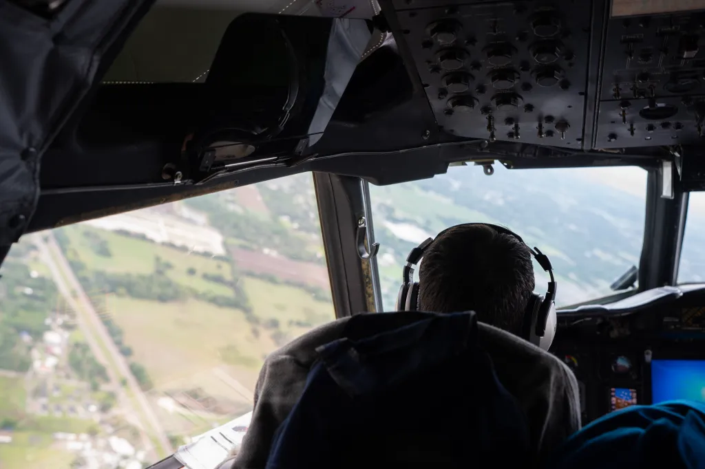
The flight took off into the clouds at roughly 10:50 a.m. and made its way toward a destination off Florida’s eastern coast — over 170 miles away from where NASA’s Artemis II mission launched just a week prior.
Over the Atlantic Ocean, the P-3 began low to the surface and spiraled up in altitude to prepare for the first drops and box patterns — a technique in which the plane flies in a box-like shape to get validation data from four different orientations to the wind.
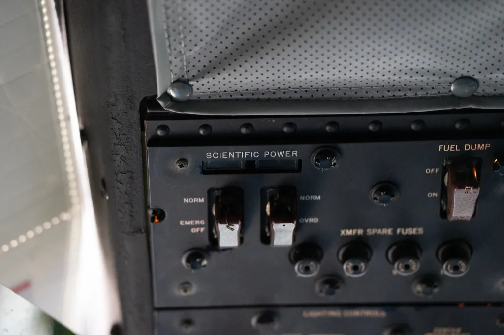
Onboard, multiple tools were slated for deployment. Those devices sit in a broader ecosystem of hurricane-monitoring tech at NOAA that includes several types of uncrewed surface vehicles, ocean gliders, drifters and floats, but they have the somewhat unique attribute of being designed to be deployed via airplane.
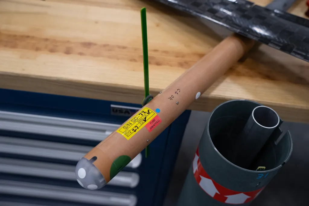
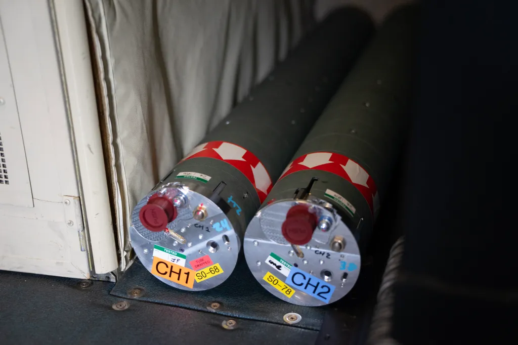
The Black Swift drones, for their part, are small and lightweight with a wingspan of about 4.5 feet and have the ability to fold neatly into tubes that serve as their vehicle out of the chute.
Once in the air, those tubes break open to release the small unmanned aircraft into the storm. While the drones can land, they’re deployed too far from the shore to make the journey back and, as a result, are single use. Per unit, the drones cost about $20,000, Cione said, though that price is expected to decrease as the agency purchases larger batches.
Those UAS have come a long way since they began development under a Small Business Innovation Research grant roughly eight years ago. First launched into hurricanes in 2023, they’re nearing a fully “operational” status — which, if reached, would make them the first UAS to be a routine tool for the agency’s hurricane operations.
On a technology readiness scale that NOAA borrowed from NASA, the SØ is currently teetering between levels eight and nine, with nine being the highest.
Cione explained that while some of the functions of the drones are considered operational, like data assimilation into the numerical models and real-time data incorporation at the National Hurricane Center, they’re just shy of being considered routine. That will come when the NHC purchases and tasks the models for missions the same way it already does for a technology known as a dropsonde, he said.
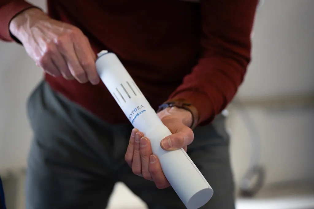
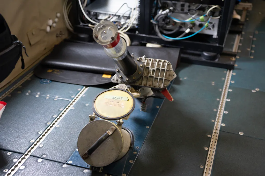
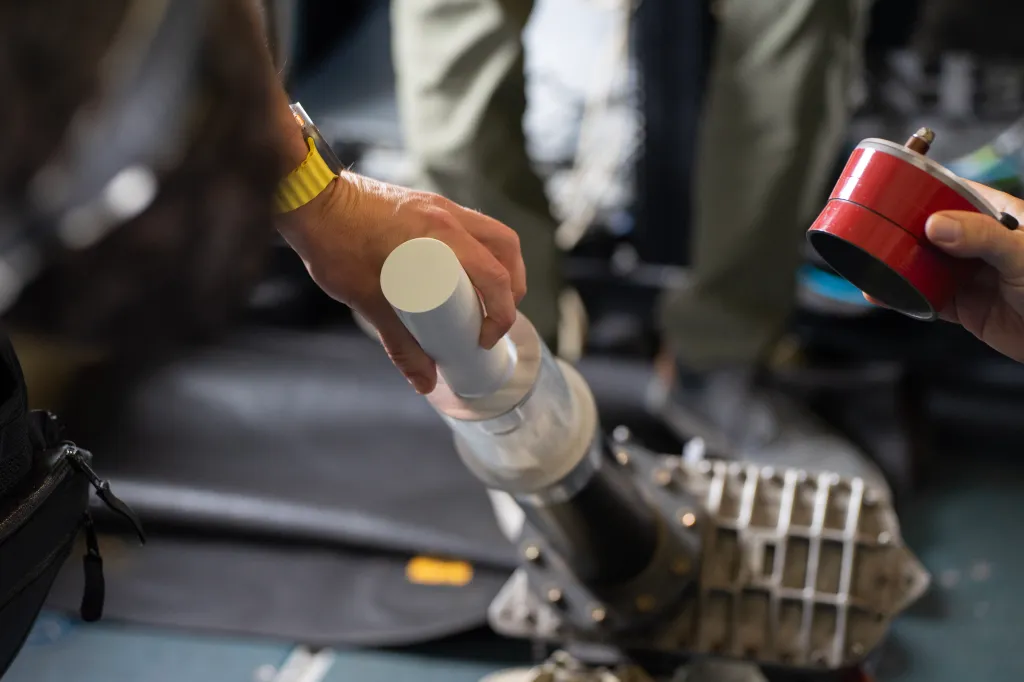
Dropsondes, meanwhile, are fully operational. That means they’re trusted enough to be a regular part of the process and often serve as a form of data validation for other newer tools being tested. Those tools are small tubular devices with parachutes attached that collect data such as temperature, pressure, humidity and wind speed on their journey to the ocean’s surface. Created by the National Science Foundation’s National Center for Atmospheric Research (NCAR), those devices are currently manufactured by the company Vaisala.
At the same time, there are ongoing efforts to iterate on the technology and create new versions that aim to improve upon things like the length of time each device can stay in the air, their overall size, and how much they cost.
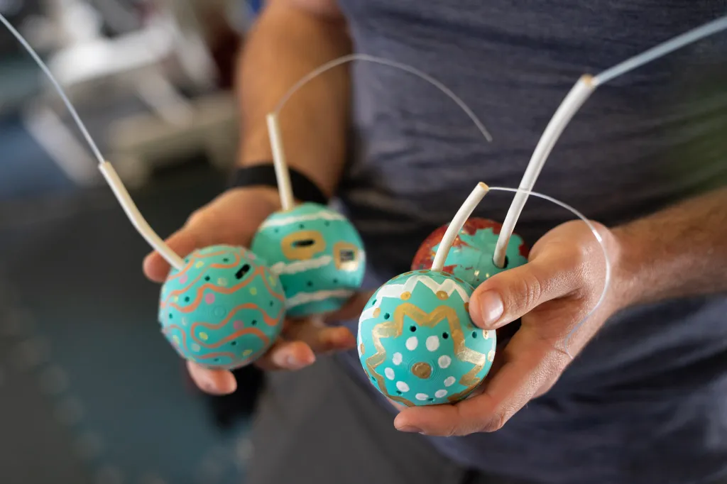
That includes streamsondes, which are a significantly less expensive tool from a company called Skyfora (less than $450 compared to about $1,200 for a dropsonde, per Cione). It also includes a novel experimental device called a spheresonde that collects only wind speed but could be the smallest and cheapest option yet.
Finding the path
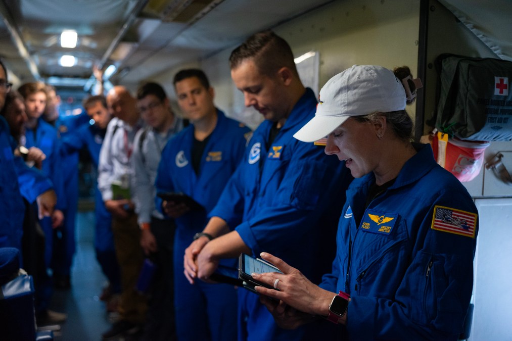
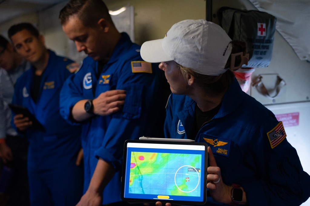
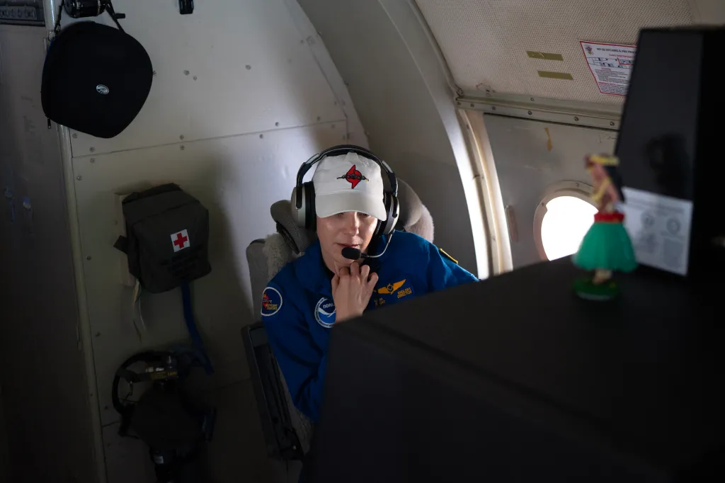
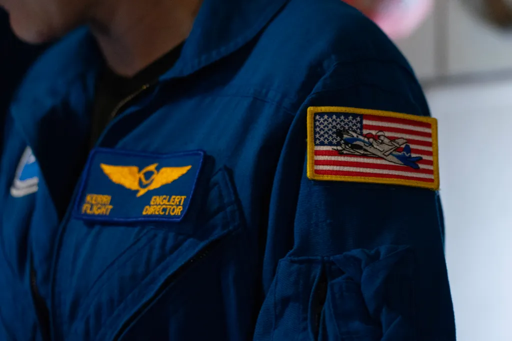
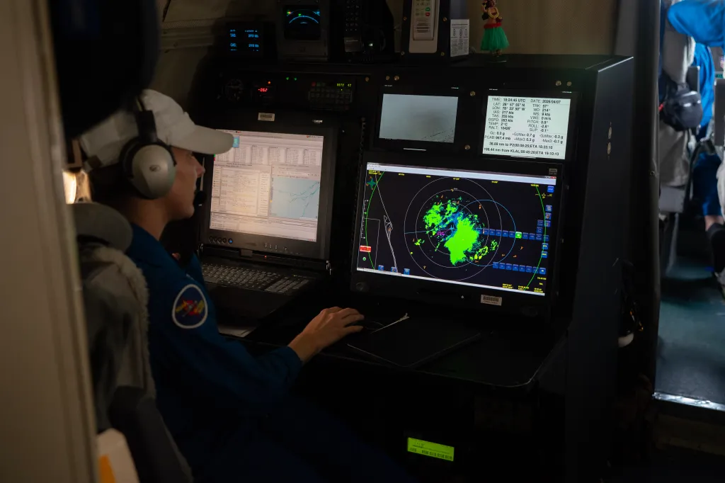
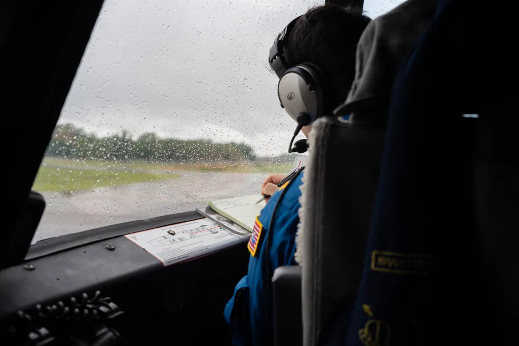
Throughout the test flight, there was a careful balance of getting the plane into consistent rain while avoiding convective cells that cause turbulence. Flight director Kerri Englert was in charge of finding that equilibrium.
P-3 flight directors serve as both in-flight meteorologists and a nexus between all of the operations on the plane, including the pilots, navigator, and science team. Englert was a frequent voice on the aircraft’s internal communications system, helping coordinate drops, finding rain and avoiding cells.
“In the northwest side of the box is where I’m aiming for. What do you think?” Englert asked Wadler over the comms during the flight.
“I like it,” Wadler said after pausing to review.
“Alright, we’ll aim for that spot … I think that should get you some decent stratiform for a little bit,” Englert replied.
The stratiform the crew was aiming for is a steady but light rain that’s fairly typical, Englert explained after the flight. “What we don’t want to do is put the aircraft in a potentially unsafe position by just trucking through those cells, so we’ll avoid them if we can,” she said.
That’s fairly similar to how the crew would approach a hurricane as well — avoiding cells and aiming for the smoothest path. But Englert said that goal is not always a reality in larger storms, and sometimes they’re forced “to bite the bullet and go through it.”
“We’ll find the softest spot we can, but at that point in time, it’s just more preparedness and notifying the individuals flying the aircraft of what they can expect,” she said.
At one point during the flight, praise for the location selection crackled through the headsets. “Kudos to you guys for picking this spot out here,” a crewmember told Englert through the comms.
Simultaneous flights and ‘ocean towers’
At 12:37 p.m., the crew deployed the first SØ, and a second followed at 12:42 p.m. The process was brief and loud. Winds roared as a crewmember lifted the cap on the end of the chute, and then in a second, the tube was gone, hurtling through the air toward the surface.
Beyond the rainy weather testing and operationalizing the data, the ability to fly two UAS at once is another major step for the program.
The April testing day was just the second time researchers had ever attempted the maneuver after an initial test in March — surprisingly to immediate success. Such capability doubles the data collection from storms and has the potential to further improve the quality of what’s ultimately fed into the models.
“As you can imagine, the storm’s quite large, so just having a single data point to try and estimate what’s going on with it isn’t ideal,” said Jack Elston, co-founder and CEO of Black Swift Technologies, who was there during the first March test. But two drones could measure different parts of the storm simultaneously or even stack on top of each other to get readings from different altitudes, he said.
To get to the point of being able to fly two drones at once, Elston said there was some technical work on radio frequencies and allocations, but the main hurdle was developing a user interface and control so that operators aren’t overwhelmed by the task. As a result, much of the process has been automated within the aircraft so the operator doesn’t have to move back and forth, he said. It also makes it easier to add more.
“The next thing is now that we’ve done two, expanding that to beyond two becomes a little bit simpler,” Elston said.
NOAA is headed into the season with a modest toolbox of 26 SØ drones, per Cione. Last year, the agency launched just under 20 drones over the course of 63 hurricane flights. But with the new ability to deploy multiple at once, Cione said, resources are expected to be depleted more quickly.
Although 2026 is predicted to be a less-active hurricane season, Cione said that when his team does have a storm, they’re going to be more aggressive in how they go about research. And with the data being assimilated into the numerical models for the first time, there’s even more incentive to collect as many observations as possible to get a better sense of the impact the drones can make.
The team is also exploring what Cione terms a “mobile ocean tower” — a maneuver in which the drone turns into the wind, roughly matching its speed, and stays fixed over the same geographic area to capture data from a specific location. The idea came about last year during a hurricane operation when researchers saw the possibility to try it out, he said.
While in that position, the drone can change altitudes and virtually scan the inside of a hurricane as the storm moves past it. That’s a benefit because it gives the agency more options for data collection. For example, Cione said, the hurricane center might see something in the storm and tell the crew on the P-3 to go take a sample.
“The real advantage of this is that we can stop where we want to,” Cione said.
Thanks to the weather during the April test flight, researchers also had the opportunity to briefly carry out an impromptu test of the tower, though the wind was nowhere near what it would be in an actual hurricane.
Over the comms, Cione could be heard coming to the realization that an ocean towers test may be possible with the windspeed. “Why don’t we do that?” he suggested.
“Alright, so, change of plans,” Wadler replied.
A turbulent backdrop
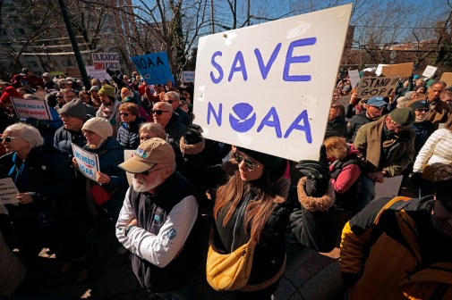
The advancements in hurricane testing and tech come at a tumultuous time for NOAA — and its research, in particular.
President Donald Trump’s last two budget requests have proposed significant cuts to the agency, including eliminating the Office of Oceanic and Atmospheric Research (OAR) as a line office and moving certain functions elsewhere. Though the emerging tech program works closely with the Hurricane Hunters, the Hurricane Research Division it’s a part of sits within OAR.
NOAA’s most recent proposal for fiscal 2027 does state plans to accelerate the adoption of unmanned systems in hurricane forecasting and research within the division that houses the Hurricane Hunters, known as the Office of Marine and Aviation Operations (OMAO). But it’s hard to tell exactly what that would mean in the context of broader proposed cuts to science at the agency and beyond.
“How can one invest in new emerging technologies when you’re not giving the office that does research for that very thing the opportunity to assess whether or not those emerging technologies are doing a good job,” said Carlos Javier Martinez, a senior climate scientist at the Union of Concerned Scientists.
Martinez noted the budget also proposes the elimination of certain flight hours within the marine aviation division, including those for OAR. The document states that the agency plans to accelerate adoption of unmanned technologies for hurricane reconnaissance, research and forecasting, but it’s unclear what that would look like amid the widespread cuts to research.

Martinez, who previously oversaw climate resilience research at the National Science Foundation, said the unexpected nature of the Trump administration’s decisionmaking is its own cause for concern amid hurricane season.
He pointed specifically to a decision last year by the administration to halt the Defense Meteorological Satellite Program — which is used in storm prediction — amid hurricane season. The administration later reversed course after outcry from lawmakers and science advocates. But rollbacks to other science programs continue to move forward, such as its recent move to dismantle a key ocean monitoring system supported by NSF.
“We have seen this administration be very slow in the disbursement of funds, we’ve seen this administration make abrupt announcements to datasets, to tools, to resources with very little to no explanation as to why, and so that’s what gives me unease,” Martinez said.
Partnerships and challenges
At the same time, in an effort to share resources, NOAA and NASA are pursuing a partnership that would encompass unmanned systems work.
At a table in the P-3’s galley, Cione told FedScoop that the agencies are working toward an interagency agreement for UAS and sensors that would help achieve the perennial goal in government of being efficient with resources. NASA declined to comment on the potential interagency agreement, but two of its researchers were present in Lakeland for the April testing day.
Among the possible opportunities Cione sees in such a partnership: NASA could gain use cases for its technology within hurricane environments and tap into NOAA’s testing facilities. And NOAA could use the space agency’s higher-flying aircraft to drop drones from altitudes its own fleet can’t reach.
NOAA would also be able to leverage the space agency’s engineering capabilities for technology development that the agencies would essentially co-own. That specific advantage has the potential to better protect the investment of taxpayer dollars in the technologies, Cione said.
“We have the scientists, we have the process, but they have a lot of very high-end engineering capabilities that they’re bringing to us to improve the drones or improve the communications,” Cione said.

Over the years of NOAA’s hurricane emerging tech program, drones have come and gone as technologies have shifted hands and pricing has changed.
The first drone NOAA dropped into a hurricane was called the Coyote, which had originally been developed for the military and was owned by a company called Sensintel at the time. That company was later bought by the defense contractor Raytheon, which is now under RTX Corporation. But the drone phased out of NOAA’s operations.
Another drone known as the Altius-600, which NOAA set a Guinness World Record with, is also no longer in use. Originally developed by a company called Area-I, it was later acquired by the defense contractor Anduril. Cione cited cost as the reason that drone is no longer part of the agency’s lineup.
Discussing that phenomenon, Black Swift’s Elston said it can be tough for small businesses supporting federal opportunities, particularly outside the Department of Defense space. The amount of sweat equity smaller companies put into these contracts without resources to hire additional help can become unsustainable, he explained.
Black Swift’s company culture is built around “seeing the unseen data that we haven’t gotten to yet,” Elston said — something made possible by the “fulfilling” work with NOAA. “But that doesn’t make you a lot of money, and it makes it really hard to kind of stay afloat,” he said.
As a result, Elston said Black Swift has been looking for other ways to smooth out the uneven funding, including through some commercial sales — though the market is limited with certain flight restrictions in place — as well as work with the Navy. But perhaps differently than others, the company isn’t looking to increase its value tenfold, he said.
“We really want to continue doing this work, and so we’re just looking for other ways to better support that without having to rely on somewhat inconsistent funding from the government,” Elston said.
Ready for action
Overall, Cione is optimistic about the future of the emerging tech work and pointed to the years of hard work, failures, and successes as the reason the program has been able to get to its current point.
Even the work the agency did with the technologies it no longer uses has helped its current drone operations start at a higher level than it otherwise would have, Cione said. “That’s part of this process,” he said.
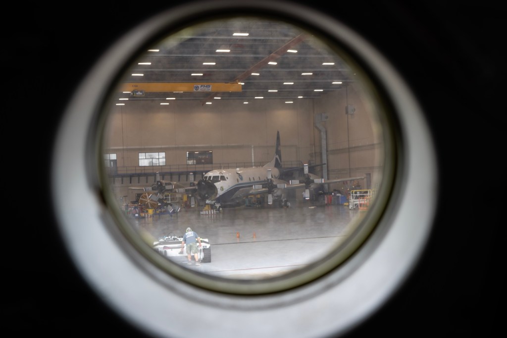
The P-3 landed back at the NOAA facility at about 3:40 p.m. While clouds still veiled the sky and wind still lapped at the flags outside, the rain had stopped. Bags and gear in hand, the crew and researchers climbed down from the plane, a group photo was taken, and everyone made their way back through the aircraft hangar, passing the rest of the fleet along the way.
Already among the crew and scientists, conversations buzzed about the next tests the team would conduct — including the recovery of the drone to compare full data available on the device itself, to what it sends back to the plane more slowly.
As for the results of the rain test? Another success.
On a recent phone call, Wadler shared that the data from the SØs was unaffected, ultimately giving researchers more confidence about how they operate inside a hurricane, away from the data validation the plane can provide.
“It’s nice to say that we know that rainy conditions don’t affect the quality of the measurements,” he said. “And that’s a big deal.”
Photos and footage by FedScoop’s Madison Alder. Video production and direction by Scoop News Group’s Cat Nguyen.