Geo-fence technology could make the U.S. Postal Service more efficient, but it’s not quite ready for prime time, according to an August 14 report from the USPS inspector general.
Geo-fence technology leverages global positioning system signals to create virtual geographic zones that ensure delivery personnel stay on schedule and on their routes.
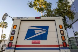
According to the IG, the Postal Service is currently developing and testing a delivery management system (DMS) that includes geo-fence technology to improve efficiency. Under the system, if a delivery driver ventures from a predetermined route, a supervisor would receive an email or text message alerting them of the deviation.
With this technology, delivery supervisors will be able to analyze whether or not a driver is ahead or behind of schedule on their route.
 If a driver deviates from his or her expected route, whether permitted or not, a supervisor will receive a text or email notification.
Source: USPS OIG
The IG found, however, that the DMS contained a flaw – if a driver takes on additional stops that are not part of his or her normal route, the data obtained by DMS would not be correct. The system would interpret the driver’s additional stops and route changes as a deviation from a planned route and deem that driver to be behind schedule even if the additional stops and changes were authorized. The inaccuracy comes with a variance in the scan data of managed service points (MSPs) as the carrier moves through his or her route.
USPS management planned to address the problem by April; however, according to the IG, as of July the flaw still existed.
“The Postal Service’s planned use of geo-fence technology will increase carrier visibility to aid supervisors in performing street management,” the report said. “Our analysis shows that MSP scan variances would be accurate on regular routes, but inaccurate when there are authorized route deviations.”
The report recommended that the Postal Service modify DMS to capture adjustments for time and location projects if a carrier is assigned an altered route before the system goes national.
According to the report, the Postal Service management agreed with the findings and recommendations. The Postal Service plans to update the software to account for route deviation by Sept. 30.